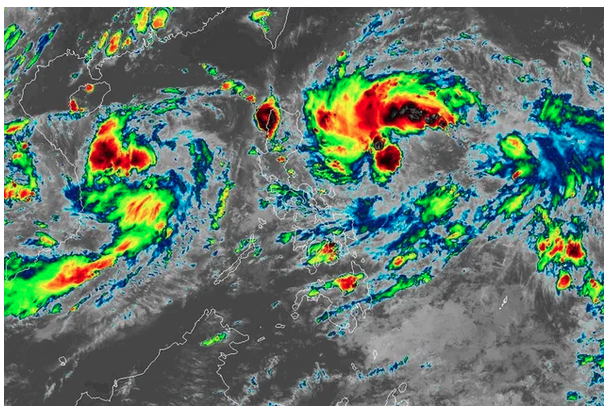
MANILA — Typhoon Henry continued to weaken while moving northwestward over the Philippine Sea east northeast of Batanes, PAGASA said Friday.
In its latest bulletin issued 5 p.m. Friday, the state weather bureau said parts of northern Luzon will continue to experience moderate to heavy rains until Saturday: Ilocos Norte, Batanes, Babuyan Islands, and Abra.
Residents in these areas are advised to prepare for possible flooding and rain-induced landslides, PAGASA said.
The rest of Cagayan, the Ilocos Region, and Cordillera Administrative Region (CAR) will experience light to moderate with at times heavy rains due to typhoon Henry.
Batanes remains under Signal No. 2, where gale-force winds between 61 to 120 kilometers per hour may be experienced.
Babuyan Islands and the northeastern portion of mainland Cagayan province, meanwhile, will also experience strong winds as these areas are placed under Signal No. 1.
PAGASA last estimated the eye of typhoon Henry about 350 kilometers east northeast of Itbayat, Batanes, with maximum sustained winds of 155 kilometers per hour near the center and gustiness of up to 190 kilometers per hour.
It was moving northwestward at 10 kilometers per hour.
Based on the latest forecast track, Henry is expected to exit the Philippine Area of Responsibility (PAR) Saturday evening or Sunday morning.
It is also forecast to weaken further in the next 12 hours, PAGASA said.
“As Henry begins to accelerate northward, a short period of intensification may take place by tomorrow morning through Sunday,” the state weather bureau added.
As of writing, disaster authorities are still verifying a reported death from Henry in Ifugao province.
Full story here: https://tinylinkurl.com/grkJt


Comments
Authentication required
You must log in to post a comment.
Log in