In its latest bulletin issued 5 a.m., PAGASA said Inday remains less likely to directly bring heavy rains to the country, but advised that the typhoon's outermost rainbands and a slightly enhanced Southwest Monsoon (Habagat) may bring rains and thunderstorms over Batanes and the western sections of Central and Southern Luzon.
No part of the country is expected to be placed under any tropical cyclone warning signal due to Inday, but signals may be hoisted over parts of extreme Northern Luzon in the coming days due to a further westward shift and the expansion in the extent of tropical cyclone winds.
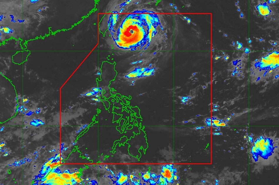
he state weather bureau last estimated the eye of the typhoon at 350 kilometers East Northeast of Itbayat, Batanes, packing maximum sustained winds of 155 kilometers per hour near the center and gustiness of up to 190 kilometers per hour. It is moving northwestward at 15 kilometers per hour.Due to Typhoon Inday, a gale warning has also been raised over the northern seaboards of Northern Luzon. It may also bring moderate to rough seas over the eastern seaboard of the said area.
According to PAGASA, Inday is forecast to move generally northwestward over the Philippine Sea east of Taiwan from Sunday through Monday afternoon, gradually decelerating during the process.
It is expected to exit the Philippine Area of Responsibility (PAR) on Tuesday morning or afternoon.
Full story here: https://tinylinkurl.com/aqIUw


Comments
Authentication required
You must log in to post a comment.
Log in