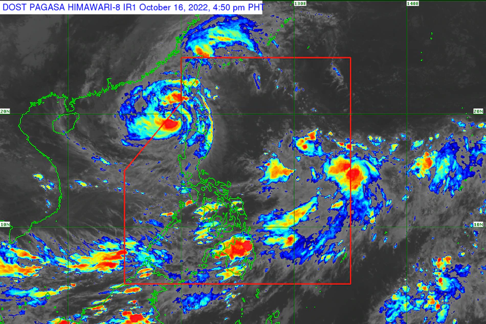
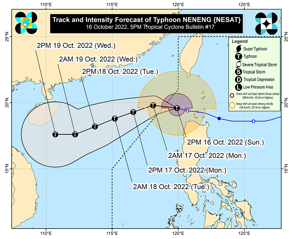
In its 5.pm. bulletin, PAGASA said Neneng was last spotted 210 kilometers west northwest of Calayan, Cagayan, packing maximum sustained winds of 120 kilometers per hour near the center and gusts of up to 150 kilometers per hour, PAGASA said.
It is currently moving west northwest at 15 kph.
Tropical cyclone wind signals are in effect in the following areas:
SIGNAL NO. 2
- *Batanes
- *Western portion of Babuyan Islands (Dalupiri Is., Calayan Is., Panuitan Is., Babuyan Is.)
- *Northwestern portion of Ilocos Norte (Bangui, Burgos, Pagudpud, Pasuquin, Bacarra)
SIGNAL NO. 1
- - Western portion of Cagayan (Allacapan, Aparri, Ballesteros, Abulug, Sanchez-Mira, Pamplona, Claveria, Santa Praxedes, Rizal, Lasam)
- *Apayao
- *Northern portion of Abra (San Juan, Tayum, Langiden, Lagangilang, Danglas, La Paz, Dolores, Lacub, Tineg, Lagayan, Bangued)
- *Rest of Ilocos Norte
- *Northern portion of Ilocos Sur (Magsingal, San Vicente, Santa Catalina, Sinait, San Ildefonso, City of Vigan, Cabugao, Caoayan, San Juan, Bantay, Santo Domingo)
Neneng is expected to bring moderate to heavy rains may prevail over Batanes, Abra, Benguet, Ilocos Norte, and Ilocos Sur, while light to moderate with at times heavy rains may also prevail over Babuyan Islands, the rest of Ilocos Region and Cordillera Administrative Region.
PAGASA said the typhoon may exit the Philippine area of responsibility on late Sunday afternoon or Sunday night.
Neneng earlier underwent "extreme rapid intensification and reached typhoon category” Sunday morning.
Full story here: https://tinylinkurl.com/mgtuA


Comments
Authentication required
You must log in to post a comment.
Log in